


-as several sections of Central Park are now inundated
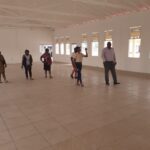
Sections of Kwakwani Waterfront, Waterfront Road and Lamp Island are now under nine to 13 feet of floodwaters, forcing 40 persons to evacuate and seek refuge at the Kwakwani Primary School, that was since converted into a shelter. While an additional 50 persons have taken refuge at the homes of families in Central Park, Kwakwani
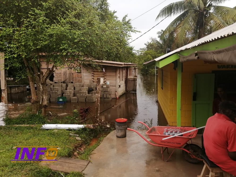
With persistent heavy rainfall, the overlapping of the Berbice River has led to floodwaters vastly entering the creeks and swamps, which has resulted in several sections in Central Park being inundated. During the May/June rains, the Central Park area is not normally flooded. With several homes in the area now under water, residents are fearful that the greatest flood the community witnessed in the 1980s will reoccur.
Areas inundated are presently are Chine Lane, Plant Site, Potsville, Second Phase Housing Scheme and homes along the eastern and western side of the waterfront road.
While this year’s flood is known to many in this era as the worst, it is nothing compared to the greatest flood to ever hit the community in the 1980s.
Fredrick David, a resident of Kwakwani for over 50 years told INFO10,” this is not fully the levels of the flood in the 1980s. It was way higher, but with consistent rainfall, rapidly causing the water levels to rise, I pray history doesn’t repeat itself, because a large section of the Park will be submerged,” David recounted.
David also added, ” the flood was so big that the Brazo (Pontoon), came through the Plant Site road approaching the Kwakwani Workers Club. The entire waterfront road was also flooded.”
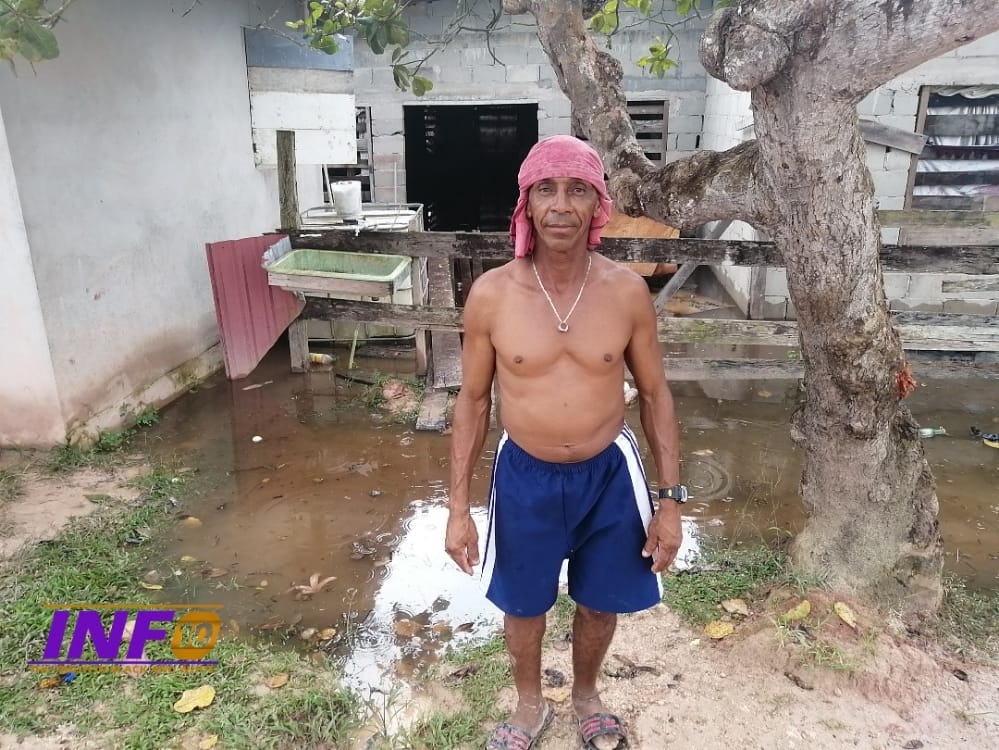
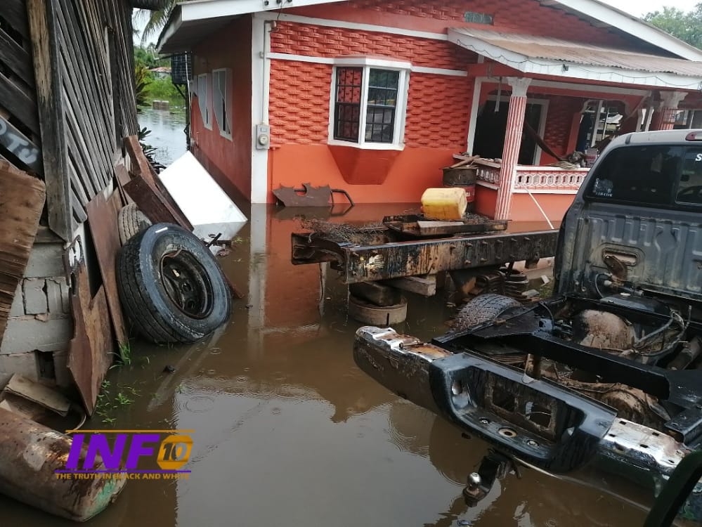
Residents in Potsville who are also hit hard, are counting their losses and forcing a family whose home is now submerged in nine feet of water to evacuate.
Latoya Mohamed, a resident of Potsville for over 20 years described this year’s flood as the most horrifying her family ever witnessed and is considering relocation in the future, due to her massive loss.
“This is history! I always had it behind my head that the water would never come this high, the water would usually come three feet under our six feet high house, It’s now nine feet. We barely managed to evacuate some of our belongings, a lot of our livestock get sick and die, while snakes killed the rest,” the distraught Mohammed said.
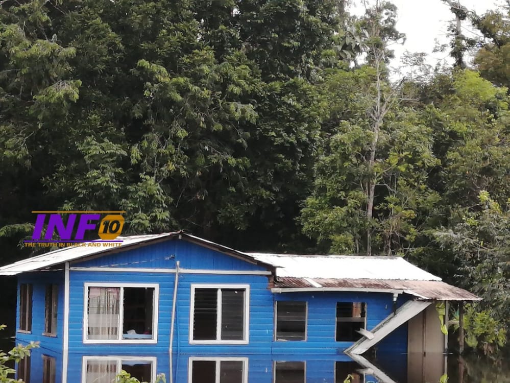
As floodwaters rapidly make its ways aback homes on the western and eastern sides of the Waterfront Road toward the roadways, families have begun to evacuate.
Phillip Leacock, a resident of Waterfront road for some 31 years, told this media house that he has never experienced this severity of floodwaters since taking up residency in the area.
Every time the waterfront is flooded, it would usually come at the back of the house, but this year’s flood meet about two feet and making its way to the roadways,” emotional Leacock said.
“I had to move out and go in the Park, water is about eight inches in my home, water would normally come 15 feet aback my house,” Kenrick Sauers told INFO 10.
Residents are confident that the dredging of the river and cleaning of clogged drains, will mitigate the levels of floodwaters in the community.
During Minister of Work Juan Edghill’s recent visit to Kwakwani to distribute 1400 hampers, he said ” we are now experiencing climate change and it is unwise to live at the river banks. I’ll like to advise residents, especially those in Lamp Island area to relocate,” Hon.Juan Edghill told INFO10 in an invited comment.
Director General of the Civil Defense Commission (CDC), Lt.Col Kester Craig, in an interview with the Department of Public Information(DPI) said,” the regions severely affected by floodwaters are region’s two, six, seven, nine and 10. The worst affected in terms of water level is Region 10, where you have in Kwakwani area and all those communities along the river.” Craig said.


Sad, my family is an old Kwakwani family. It is sad to see the distress in the faces I know and grew up with.